Got feedback? Additional questions? Just want to have a friendly chat?
Get in touch!
Available parts
- Goal
- Roadworks, traffic diversions, and floating vehicle data (current)
- Setting up a traffic flow analysis project
- Analzying traffic flows using basic filters
- Analzying traffic flows using advanced filters
- Further reading
The Rahmede bridge and traffic diversions
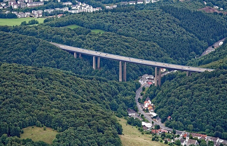
Figure 1. The Rahmedetalbrücke, a bridge on the A45 in Germany that was demolished, leading to a lot of traffic headaches.
In 2021, a bridge on the A45 near Lüdenscheid in Germany was identified to be unfit to carry anymore traffic and the highway section was closed, followed by a demolition of the bridge.
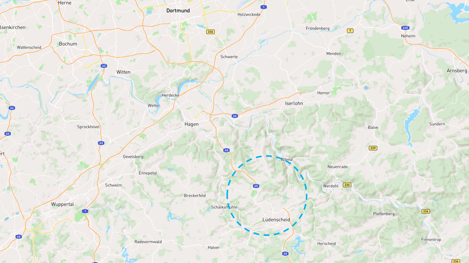
Figure 2. Area where the highway is cut.
Given that this highway section is in a densely populated area in central Germany, also seeing a lot of through traffic from neighboring states and countries, the impact on the traffic flow was and is tremendous.
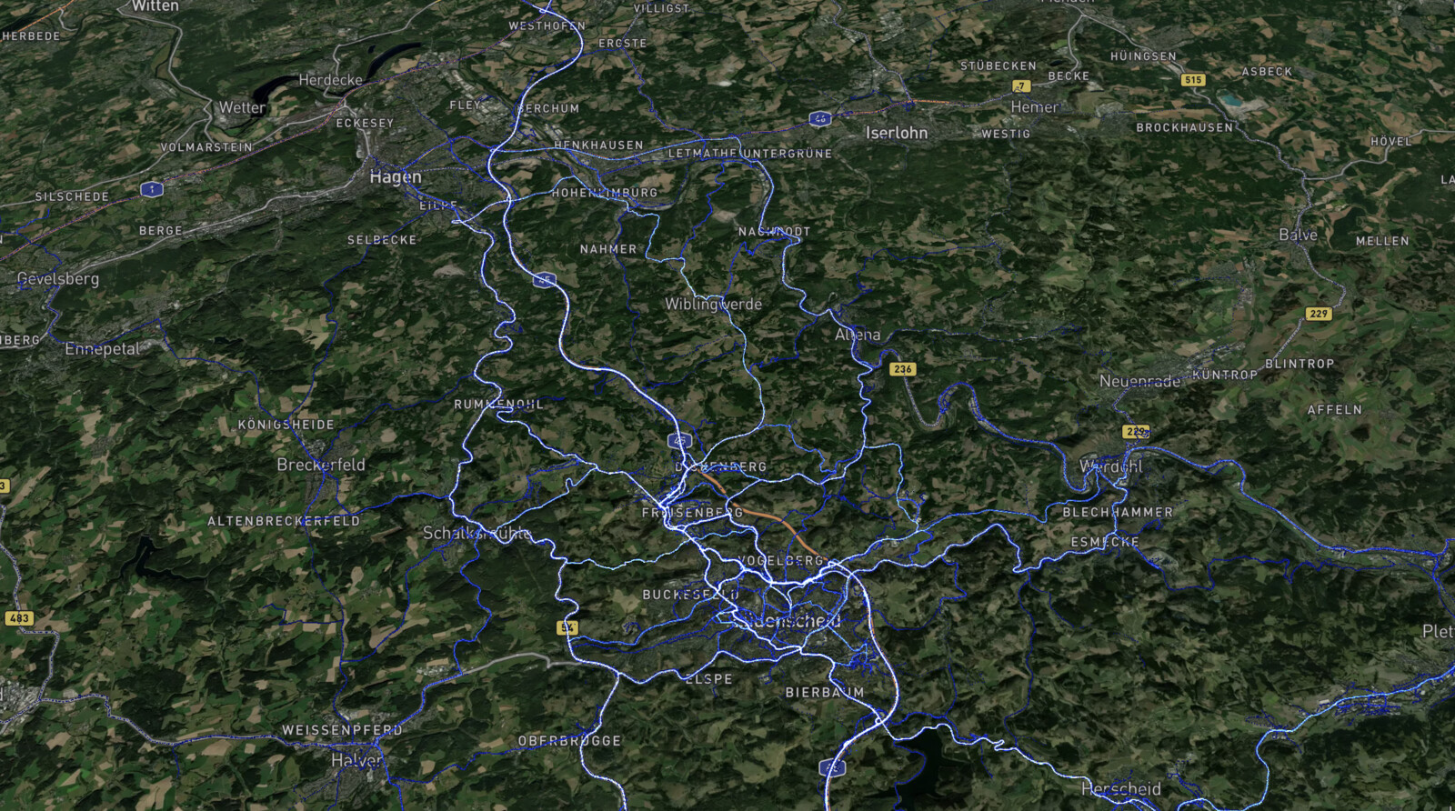
Figure 3. Heatmap of traffic flowing near the area of interest.
Large-scale traffic deviations are in place, but how to monitor their effectiveness? Using floating vehicle data, an analyst can obtain information on how and where people drive.
In this tutorial you will learn how to leverage such data using a powerful advanced query language, and analyze the effectiveness of traffic diversions.
About INRIX trips data
In this tutorial, we will use one of the sample data sets provided by INRIX. Such floating vehicle data is called INRIX trips data.
A trip is the movement of a vehicle from point A to point B.
-
Each trip consists of a sequence of waypoints. The trip itself has associated properties such as the type of vehicle, the trip length.
-
Each waypoint corresponds to the (GPS) location of a vehicle at a certain time. It has associated properties as well, including the vehicle speed.
Each trip is defined by a unique identifier (the TripId). The trip waypoints refer to this identifier, i.e., the TripId is a property of a waypoint. An INRIX trips data set can consist of millions of trips and billions of waypoints.
Next part
Go to the next part: Setting up a traffic flow analysis project
Got feedback? Additional questions? Just want to have a friendly chat?
Get in touch!