Got feedback? Additional questions? Just want to have a friendly chat?
Get in touch!
Available parts
- Goal
- Step 0: Obtain data
- Step 1: Create data set
- Step 2: Define data structure
- Step 3: Configure processing settings
- Step 4: Upload the csv files
- Step 5: Use your data set (current)
- Further reading
Step 5: Use your data set
Once processing is finished, you can start analyzing your data set. For this, you will need to create a project and add the data set to it.
Follow these steps:
-
Click on New project
-
Provide a name,
AIS dataand optional description (we leave it empty for now), click CREATE PROJECT. -
Attach our data set:
-
Click on Data Sets.
-
Click on YOUR DATA SETS (…).
-
Click on ATTACH on the US Coast Guard AIS data 2020 card.
-
-
Add a background layer:
-
Click on Background layers.
-
Click on the ADD BACKGROUND LAYER button in the top-right corner.
-
Select the Satellite & Labels Mapbox layer and click ADD MAPBOX BACKGROUND LAYER.
-
Click on SAVE.
-
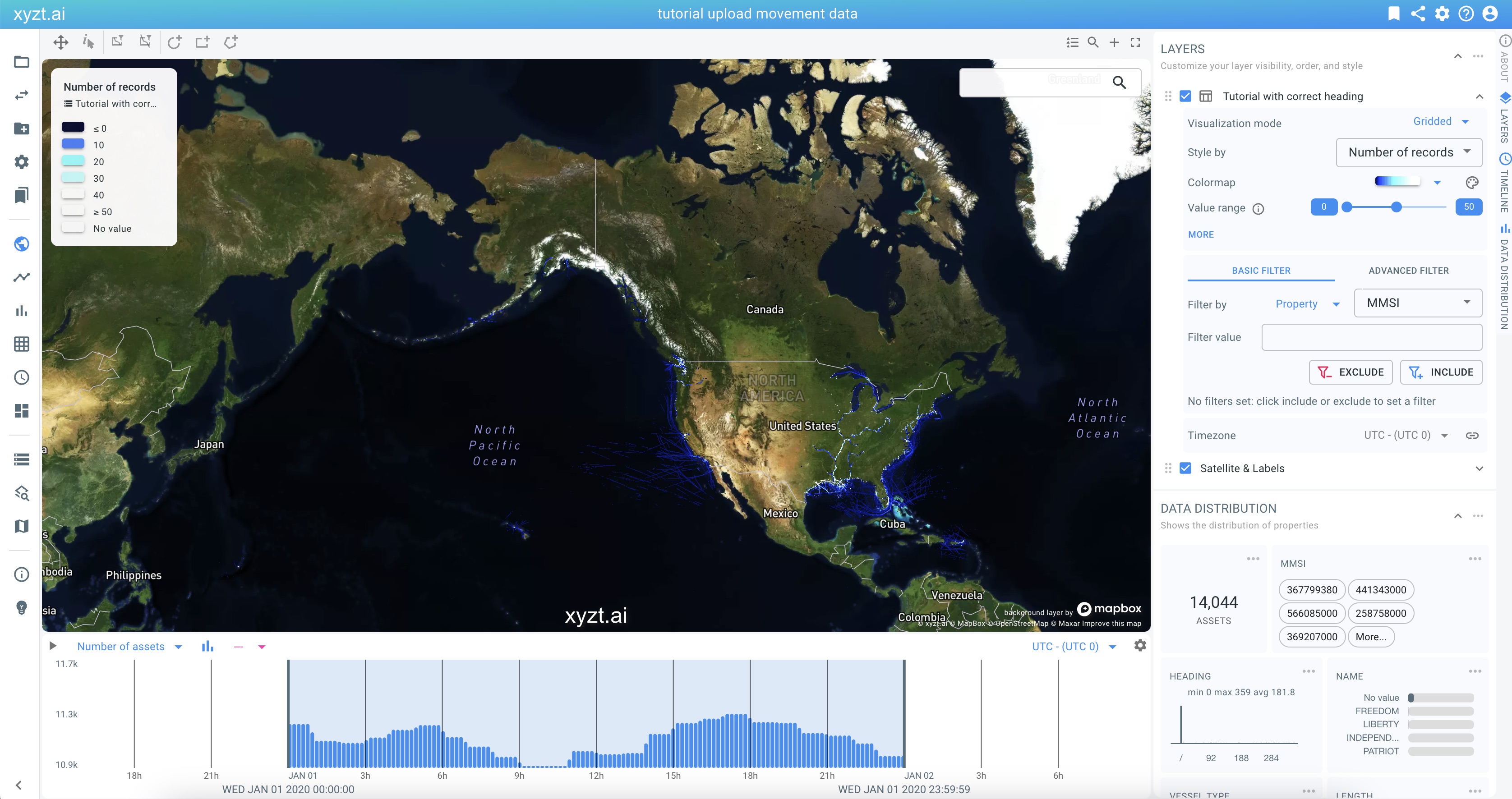
We now have a project set up with our uploaded data and a background layer.
Click on Visual analytics to see your data on the map.
Figure 1. Your data set is uploaded, processed, and ready for (visual) analysis.
Next part
Go to the next part: Further reading
Got feedback? Additional questions? Just want to have a friendly chat?
Get in touch!