Got feedback? Additional questions? Just want to have a friendly chat?
Get in touch!
Available parts
- Goal
- Understanding floating vehicle data (current)
- Create new project
- Visual analytics
- Trend analytics
- Origin-destination
- Create a dashboard
- Sharing your insights
- Conclusion
Step 0: Understanding floating vehicle data
The data that we will be using in this tutorial is a trips data set from INRIX. It is already present in your account.
To load a project containing this data set:
-
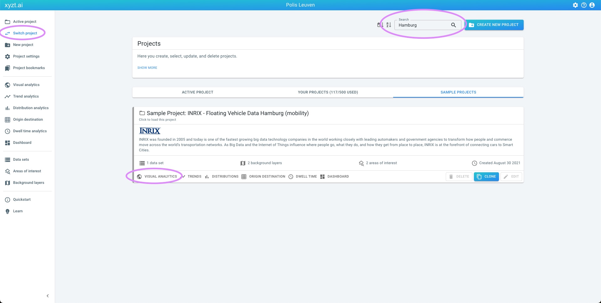
Click on Switch project on the left navigation bar
-
Click on SAMPLE PROJECTS
-
Search for
Hamburgin the Search box at the top of the page -
Click on the VISUAL ANALYTICS on the card Sample Project: INRIX - Floating Vehicle Data Hamburg (mobility)
Figure 1. Example project with sample floating vehicle data from INRIX.
This will take you to the Visual analytics page.
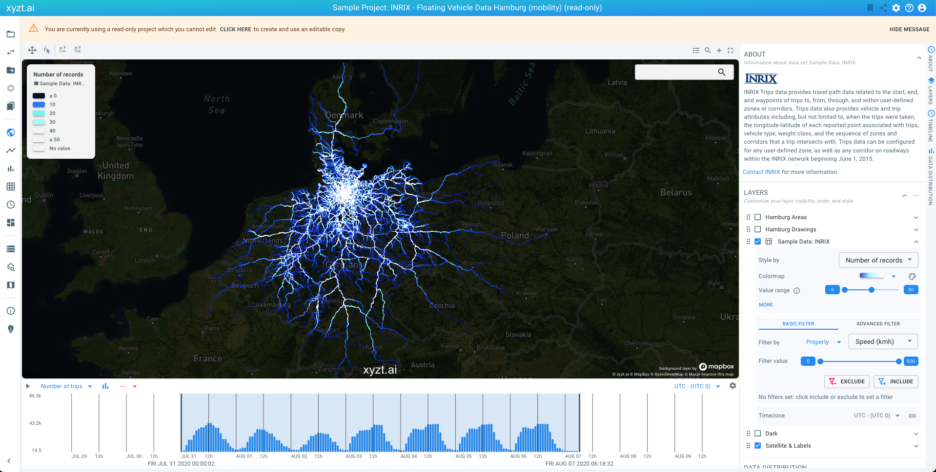
Figure 2. Analyzing traffic with floating vehicle data.
This map-centric page is the center of the platform, and probably what you will use most.
The visualizations you are looking at are different views on the floating vehicle data records:
-
The map shows a density map from dark blue to white, show where most cars drove for the given time period.
-
The timeline at the bottom of the screen shows a histogram with number of trips over time, counted in periods of 1h, 3h, etc.
-
The lower-right side shows smaller widgets with distributions of properties in the data. You might have to scroll down to reveal the widgets.
Floating car data consists of GPS locations of cars, recorded at multiple time instances (for example every 5 seconds), with possibly many associated attributes such as velocity, acceleration. Other properties often found in floating vehicle data are:
-
make of the car
-
weight of the car
-
whether the fog lights are on or off
-
…
In the example data set, following properties make up each record:
-
Trip identifier: a unique identifier that tells the platform which records belong to which trips. A trip is defined as a consecutive number of records recorded from the same car traveling from a start to an end destination.
-
Longitude: the horizontal coordinate (typically in WGS-84 reference)
-
Latitude: the vertical coordinate (typically in WGS-84 reference)
-
Time stamp: the time the record was logged
-
Speed (KMH): the speed of the car
-
Heading: the heading of the car (in degrees)
-
Total distance (KM): the total distance traveled along the trip
INRIX provides many more properties or attributes with trips data, but for the case of simplicity, these were left out in the example data set.
Connected cars are the new sensors on the road and the data they produce is replacing traditional traffic measurement means such as CCTV cameras and traffic counters.
In the following steps you will learn how powerful the data is when paired with the right analytics and visualization.
Next part
Go to the next part: Create new project
Got feedback? Additional questions? Just want to have a friendly chat?
Get in touch!